Railroad Map Prints
.jpg) Charlotte (1965) 24X24 RR Map Print Norfolk Southern, Piedmont and Northern, Seaboard Air Line, Southern Railway | .jpg) Fuquay-Varina (1977) 24X24 RR Map Print Norfolk Southern, Durham & Southerm |  NS and SAL Railway (Smokey Hollow) ~ 1952 Topography Outline Map Print 5 Sizes Available |
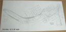 Raleigh NC Railway Yards (NS, SAL, SRR) 3-1952 ~ Large outline print copy 18 X 36 |  old Norfolk Southern Railway Glenwood Yard ~ Topography Outline Yard Print |
|  Seaboard Air Line Railway (Raleigh Yard) 1954 (1959) ~ Very Large outline print | 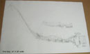 Seaboard Air Line Railway Raleigh Yard 1954 & 1959 ~ Complete outline print |
Detail Information
Our Printed Material: A few years ago these Railroad Prints were found to have been stored for over 20 years. All of these original prints have been scan and saved on a CD at Duncan-Parnell where they do most of our printing. Some prints may have cleaned some on the outer edges.
• Outline Blueprint,
• Large Outline Prints,
• Topography Outline Yard Print,
• Passenger Car Diagram Books.
These prints are great for the Railroad Enthusiasts and modelers interested in the old railroads from the 1950's in Raleigh, North Carolina. These prints can be framed, hung on the wall of your railroad club room or anywhere framed. This is how it was in the days long gone. This was the time of the diesel era and the steam locomotives were being phased out then.
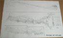
Most of these prints show the railroad turntable and roundhouse location. Captial Blvd. was not even built then, which is now located in the low area between the two railroad yards. At the North end (top right) is "Edgeton Junction" where the two railroad tracks cross. This map consists of some streets that may no longer exist today. We also have the Right-Of-Way and Track Map print of the "Edgeton Junction", 10X20 and 16X30.